I like to think I am pretty good at reading maps. I understand topo lines and can tell a valley from a ridge from a summit. I know to look for scale and that sometimes 39-foot cliffs don’t show up on a map with 40-foot contours. I also know that maps can lie and mislead and that people use them for political or other sinister purposes. That being written, I didn’t expect to question my navigational talents via a small map illustrating part of a Washington State Park. But I was.
Over the weekend, my wife and I stayed in a cabin at Deception Pass State Park, at the north end of Whidbey Island. Perhaps I should have been forewarned about geographic shenanigans. Some Whidbites claim that their island is the longest in the United States. New York’s Long Island is far longer, but a unanimous 1985 U.S. Supreme Court decision rendered that point moot. They justices wrote that "Long Island, juridically, is a peninsula" and not an island. Such brilliant logic has facilitated the Whidbites’ bogus claims of exaggerated superlatives of island size.
In our cabin was a handy brochure with information and maps about Deception Pass. Looking at it, I noticed a section of the park where we had not hiked. Known as Hoypus Point Natural Forest Area, it juts north on the east side of Deception Pass. Hoypus has a high spot of 400 feet with steep sides on the west and east. Our plan was to circumnavigate the point and explore a complex of short, interconnected trails on the undulating area south of the summit. We were slightly concerned that the map’s legend listed 30 trails in the park and the map failed to show trails 27 to 30. But we figured we’d deal with it; after all Marjorie is an Excel whisperer and knows how to deal with obstinate numbers.

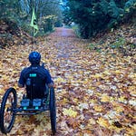
So, without a care in the world, we set out along the water. We were soon passing by Douglas firs wider than my outstretched arms, some so tall it took “two men and boy to look to the top,” as logger and historian Stewart Holbrook wrote in 1938. (I have long liked this phrase but recently learned, to my horror, that Holbrook wasn’t the first to use it; it’s been lurking around humor columns in newspapers since at least 1841. Apparently the first guy looks up until he’s tired and the second guy, aided by the boy, takes over from there.) Sadly, since we weren’t a party of three, we couldn’t actually see the tops of the trees.
As we walked around the bend we came to our first, well-made wooden sign, alerting to us being on the East Hoypus Point Trail (no. 17). We didn’t think much of the deviation from the map (which indicated we were in Fern Gully) figuring that we were headed the right way. Continuing on, we zigged and zagged, passing by other signs that didn’t match the names on the map. But still we weren’t worried. We had had a cup of coffee earlier so weren’t too concerned about caffeine headaches and Marjorie had several chocolate bars. We had also had a Vitamin C-enriched drink the night before, which most likely meant we would not get scurvy, the notorious and dreaded disease of misplaced souls. Clearly, we were up for whatever challenge awaited us at Hoypus Point.
Two hours into our walk, we sensed that we were mostly traveling in the direction that would complete our proposed loop. Yet, the trail names on the map placed us far to the north and east of the trail junction that a passing runner assured us was our present location. The runner slowed down enough to say that all we needed to do was take a right and left and we’d find the trailhead. Still doubtful, we broke down and turned to our phones. They have 120 million times the computing power of the Apollo Guidance Computer that directed humans to the moon. Despite all of the vaunted power of the phone though it failed to show the left turn our runner friend described and which showed up on our printed map.
Bold and intrepid as ever we sallied forth and found the left turn, which the map listed as Hemlock Hideaway. Again, this did not jibe; we had encountered a Hemlock Hideaway about 45 minutes earlier and the sign at the left turn said West Hoypus Point Trail. At this point, Marjorie turned to her chocolate, ate some, and declared that we would head up this trail, hemlock be damned. About 15 minutes later we reached our starting point, where we looked at a map on the kiosk. It showed what we suspected. The handy brochure map was either made as a joke, created by a geographically-challenged cartographer, produced without a copy editor, or was a sinister plot on the part of State Parks to annoy hikers. Or all four.
I tell you this story for several reasons. First, with the vile, immoral, and selfish proclamations oozing out of Washington DC, it seems that some silliness is necessary. Second, despite the cartographic issues, we had a splendid time; after awhile, all we could do was laugh at the signs and map. As usual, being outside was rejuvenating and seeing the big trees was inspiring and hopeful. In addition, our experience reaffirms my belief that when outdoors, one shouldn’t rely implicitly (or explicitly) on phone-based maps. They don’t provide the scale one often needs to navigate large spaces. Plus, they seem to push people to not pay attention to their surroundings. If we hadn’t been so diligent, and wired on caffeine, we might still be lost!
Finally, Hoypus Point is truly a lovely area. Studded with big trees, many of which bear marks of fires from long, long ago, it is an unusually intact Puget lowland forest. Many additional trees have complex growth patterns, such as multiple trunks or bent trunks and branches (both close to the ground and high up). And, despite the misinformation on the map, we did find the Big Marsh and Slug Slough (though no slugs). It is always a pleasure to travel locally and find new places to explore. In the future, though I will be more careful in basing my explorations on free brochure maps.
It’s not too late to get a paid subscription to my newsletter. As I noted last week, paid subscriptions are central to enabling me to write these newsletters every week. Surely, you don’t want them to stop.
Sources: Stewart Holbrook, Holy Old Mackinaw: A Natural History of the American Lumberjack, 1938.


