Happy Holidays to all.
A couple of weeks ago I explored the world of ghost creeks in Seattle. Now, I’d like to turn to ghost lakes. Like ghost creeks, these are bodies of water that have been overlooked, buried, or long forgotten. They are far rarer in the city though some still rise from the dead and haunt their former landscapes.
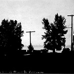
I know of only two, Seattle ghost lakes that merited names. The northern one was Oak Lake. Located roughly between North 100th and 107th streets and Ashworth Avenue North and Aurora Avenue North, the small lake does not show up any maps. We know about it from a couple of photographs and because it inspired the name of the Oak Lake School, which was open from 1886 to 1985. (Only one legacy of the school remains, the student overpass on Aurora.) Perhaps the oddest aspect of the lake was the use of the name oak (most likely our one native Quercus garryana). What makes this unusual is that oaks were never common in Seattle, perhaps growing only at Oak Lake and south of Seward Park (coincidentally at a site of another former school). We have no clue when Oak Lake disappeared but as a ghost, a tiny artificial hint remains. In 2013, Seattle Public Utilities completed the Midvale Stormwater Pond in the vicinity of the former Oak Lake.

Seattle’s other named ghost lake was first noted in an 1855 survey of what is now Sand Point/Magnuson Park. Described as a small lake in a swamp, it appears to have inspired the Native place name of Cha7áhLqoo. The name means “digging in the water” and probably refers to wapato (a potato-like tuber) collected in the wetlands around the lake. Mud Lake, as settlers called it, first shows up on USGS maps from 1894. It covered about 40 acres and was home to cutthroat trout and non-native bass and perch (introduced in the late 1800s). Mud Lake shrank in 1916 after Lake Washington was lowered by nine feet for the Ship Canal, and died in the 1930s, when WPA workers covered the flat area with runways for Sand Point Naval Air Station. But as ghosts are wont to do, Mud Lake partially arose from the dead (with the aid of volunteers) in 2009 with a restoration project that established wetlands and small ponds in the vicinity of the former lake.
I suspect that Seattle may have had other ponds and lakes that disappeared before they earned a name. In particular, I am thinking of the bogs that formerly existed. Each of these wetlands consisted of a small pond (e.g. Mud Lake) surrounded by vegetation such as sphagnum moss mats, bog laurel, Labrador tea, and sundews. All were gone by at least the mid-1950s though two still ghost their former homes. Covered by a grassy field, the former bog and pond of Big Swamp keep the ground at Dahl Playfield, (25th Ave. NE and NE 80th St) damp and spongy. Another more destructive bog around N. 87th St. and Palatine Ave. has led to sinkholes, buckled sidewalks, and sunk foundations and roads. Unfortunately for property owners, this bog’s poltergeist is persistent and continues to disrupt the area.
I would be remiss as a geodork if I didn’t mention our two largest ghost lakes: Glacial Lake Bretz and Glacial Lake Russell. Toward the end of the last Ice Age, when the great glacier that covered the Puget Lowland began to melt, its snout acted as dam, which retreated to the north. As water from this melting glacier, as well as the mountain glaciers, drained into what we now call Puget Sound, a multi-fingered body of water known as Glacial Lake Russell formed. Covering all of the south Sound (it drained south), it extended as far north as Lynnwood and had shorelines as high as 380 feet above present sea level. Younger and covering more ground to the north was Glacial Lake Bretz. The two lakes persisted for perhaps 1,000 years or more. The most visual evidence of these lakes are deltaic gravel deposits, which were mined for decades, at places such as Richmond Beach Park and what is now Chambers Bay Golf Course.

Seattle also has what I would consider to be honorary ghost lakes, in that few people seem to know they exist. I am slightly embarrassed to admit that I had long known of one of them, Haller Lake, but never gotten to its shores. (Once known as Welch Lake (for John Welch, who homesteaded there in 1869), it got its modern name in 1905, when Theodore Haller began to develop the area.) The one time I tried, I ran down what turned out to be a private lane and encountered a less-than-friendly resident. I thought all of the access roads were private until I looked at a map and found two public street ends. When I visited them the other day. I found a quiet lake, a nice bench, and many docks. The access roads are Meridian Ave N., south of N. 128th St. and N. 125th St. east of Densmore Ave. N., which takes you to an official Street End park.
Easier to access is Bitter Lake (near N. 130th St. and Linden Ave. N.), which was once a station on the Seattle-Everett Interurban, as well as the site of a farm where you could buy Crystal White Orpingtons, award winning egg layers of the poultry kind. Surrounded on three sides by buildings, the lake opens to Bitter Lake Playfield on the south end. The name comes from a long gone sawmill on the south end, which led to tannic acid dumping into the lake, rendering it too bitter for horses to drink, or so the legend goes.
Like most urban areas, Seattle has erased much of its surface aquisystem under concrete and buildings. Ironically, the city has had to build a new infrastructure to address the attributes provided by the ghosted lakes and creeks. These benefits include improving water quality and habitat and reducing flooding and sediment retention. Addressing these issues has led the city to develop a new aquisystem of detention/stormwater ponds, such as Midvale. At least 53 exist, dotted across the city. They are the ghosts of waterways past, a subtle reminder that water has long been central to the story of Seattle, and will continue to shape it long into its future.
Thanks to Derek Booth, Ralph Haugerud, and David Dethier for information on the glacial lakes, and to Valarie Bunn, for information on the Big Swamp. Thanks to the Friends of Street Ends for their work in preserving and making people aware of these fine assets and access points to water.
I just looked and I am just a few subscribers short of 3,500. It’d be nice to end the year above that number so I have a favor to ask. If you have friends who might be interested in a free subscription, please forward information about the Street Smart Naturalist to them. Thanks kindly.



Share this post