No place in the US (excluding Alaska) is as glacialrific as the Cascades of Washington. Mt. Rainier alone has more glacial ice than any other lower 48-state by a wide margin, including eight or so glaciers larger than any outside of Washington. Number two in glacial coverage is Mt. Baker, with a bit less than half that of Rainier. As anyone knows who lives or has visited here, you can see easily see glaciers across the region, particularly on the volcanoes.
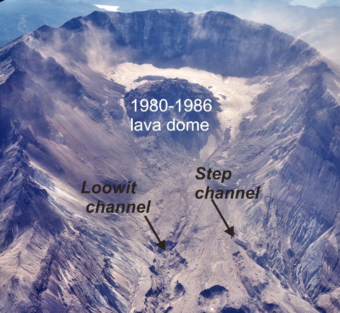
What many do not know and few have seen is the world’s youngest, and arguably totally coolest, glacier. It sits in one of the planet’s newest landscapes, the Gen X-era crater of Mount St. Helens, born out of the mountain’s May 18, 1980, eruption. Although the cataclysm beheaded the summit and wiped out 70% of the volcano’s glaciers, it also created an unexpectedly ideal location (high, steep surrounding walls that reduce sunlight and generate abundant rockfalls and avalanches, and decent annual snow fall) for a new glacier to form. Aptly named Crater Glacier (though originally dubbed Amphitheater Glacier), the big mass of ice consists of two arms spreading around the volcanic domes also forming in the crater, which measures about 1.2 miles (east-west), 1.8 miles (north-south), and 2,084 feet deep.

Ever since the crater formed, it has been the site of a clash between lava and snow. Initially, heat from the growing dome overwhelmed snow and ice but by summer 1985 a snowbank had begun to form though debris from rockfalls obscured much of the snow. (By insulating the snow/ice below, the rock enhanced the glacier’s development.) A year later, the snow had become ice but it lacked a key feature of glaciers, the crevasses that indicate movement. They would require another decade of snow and ice accumulation; in September 1996, researchers declared that the frozen stream was indeed a crevasse-riven glacier (total area about 1.2 million square feet, or about 20 downtown Seattle blocks). Five years later it was ten times that size, of which about one-third was rock debris that had fallen off the surrounding walls.
Then in November 2004, as the volcano began another round of eruptions, a lava spine pierced the glacier at the south wall of the crater, splitting the glacier in two. That didn’t stop the ice’s advance, and by March 2008, the arms had embraced on the north side of the dome. “Fortunately, nature has alleviated the clash between official nomenclature and reality on the ground,” wrote the linguistically-concerned USGS geologists in their 2010 report. Since reuniting the Crater Glacier has continued to grow and morph, fed by a cocktail of snowfall, rockfall, and snow avalanches. Ever present and fed by a magma conduit, lava has not abandoned the skirmish and continues to influence the glacier primarily by developing almost two miles of ice caves (which have been named and explored) adjacent to the dome.

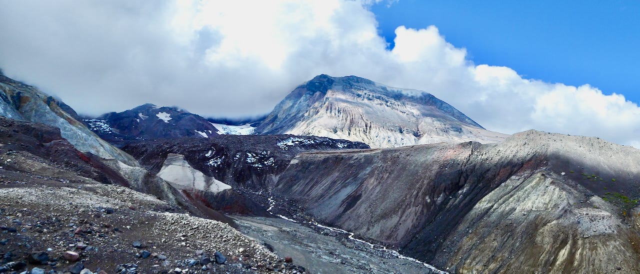
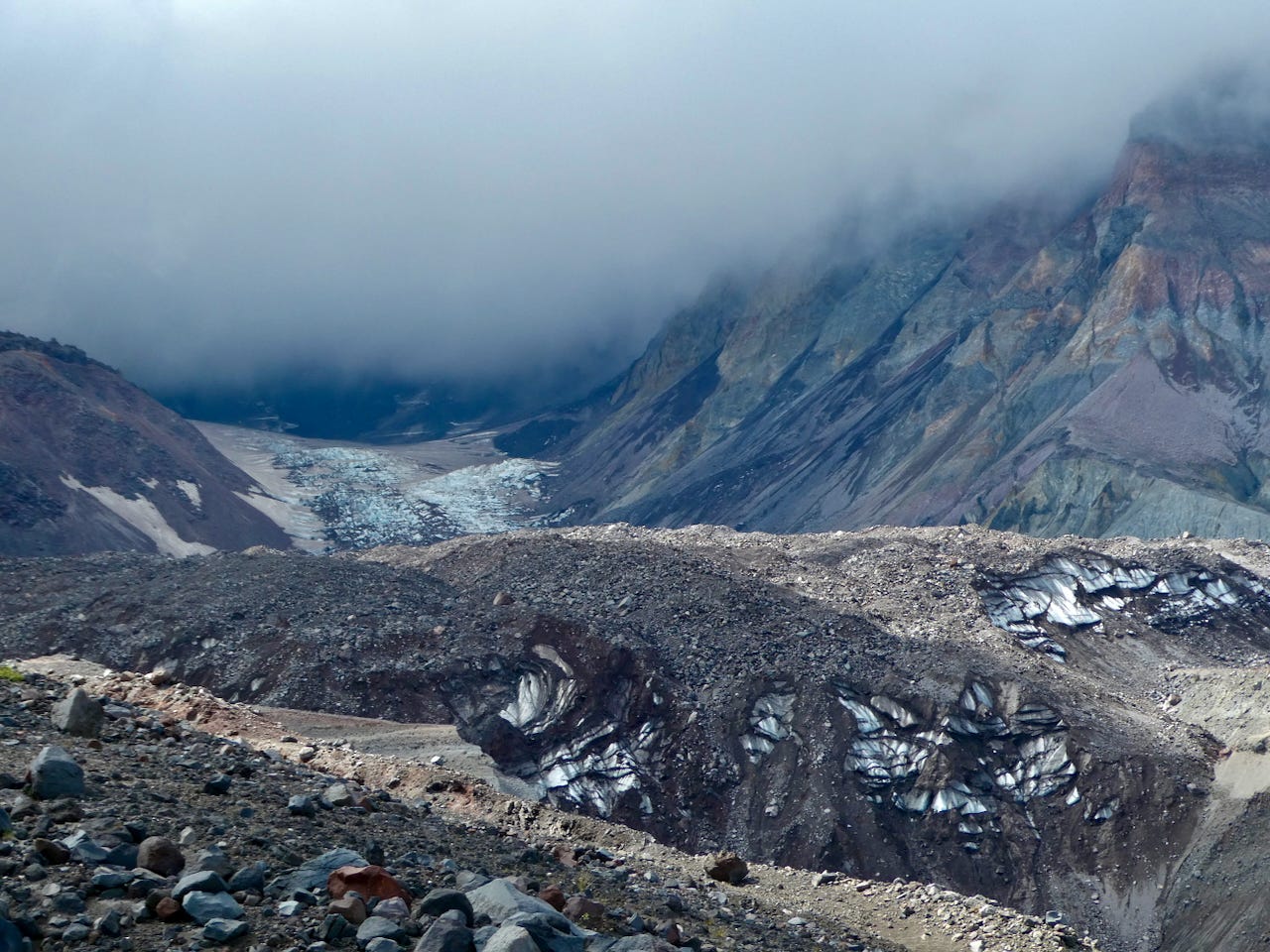
As the my photographs show, I was lucky to get up close to the Crater Glacier over the weekend. I was on a guided walk led by the Mount St. Helens Institute. (It’s illegal to go off trail so the only way to access this area is with a guide.) I took that photo at about 5,260 feet in elevation, a little over 500 yards from the toe of Crater Glacier. The night before an epic thunder and lightning storm had nailed the mountains and, the day we headed up, clouds shrouded the summit though it was clear above us and to the north, which led to spectacular lighting.
The glacier viewpoint is one of the more stunning places I have been. At my feet was a kaleidoscope of broken bits of the volcano, a color scheme repeated in the walls surrounding me. Dotting the ground, a few willows, pussy paws, and grasses (Agrostis sp.(?)) had begun the process of transforming the barren ground back to a fully vegetated ecosystem. To my west descended the Loowit Channel, a deep, multihued, 44-year-old canyon, carved into the volcanic deposits and, rising directly in front of me, an ever-growing volcanic dome—a dark reminder of the underlying forces relentlessly pushing up to form a new edifice—enveloped by the frozen arms of the glacier, one of the few natural ways (another, of course, is the mountain itself, as happened when the 1980 eruption blew off Mount St. Helens’ top 1,314 feet) to temper the inexorable rise of magma.
Where I stood, I was witnessing geology at its most primal, of some of the youngest land on earth, actively being formed in a pit of explosive devastation; and of the youngest glacier on Earth, actively growing because of the vagaries of climate and topography. It was a curious juxtaposition wrapped in an oxymoron: molten rock in tension with solid water, fire and ice side by side. For a rock geek, life does not get any better.


Wow, what a very cool (OK, yeah, and "hot") place! I loved seeing the wonderful photos.
Wonderful!! So glad you were there observing the rapid pace of geologic (and biological ) change and reporting to us!! Most of the space occupied by the growing dome and glacier was formed by that unbelievable rock avalanche/debris flow that carried the top of the mountain to the north. You've previously reminded us that this could happen at Mt. Rainier....or Mt. Baker, giant edifices of rotten rock covered with snow and ice!