In honor of July 4, I would like to mention one of Seattle’s most famous events, the Independence Day picnic of 1854 hosted by Thomas Mercer. The story goes that whilst serving up some small batch treats, Mercer proposed the name Lake Washington for what was then known by a variety of names—Lake Geneva, Lake Duwamish, or hyas chuck, Chinook jargon for “big waters.” He then suggested the name of Union for the smaller lake where everyone had gathered, noting the possibility “of this little body of water sometime providing a connecting link uniting the larger lake and Puget Sound.”
I have often wondered why Mercer made the second suggestion. It may have been because he used his horse and wagon to haul goods in Seattle’s challenging terrain and thought that water offered a better means of transportation. Mercer was also well acquainted with the Native people and could have been inspired by seeing them canoeing the route between salt water and freshwater, where they traveled to harvest plants and animals.
But Tom Mercer is not why I am writing today. The real reason is to look at maps and to see how Lake Union has been portrayed over time.
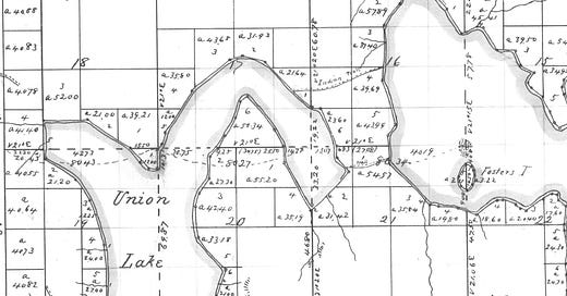
1856 - This is the earliest map I know that shows Lake Union, done by the General Land Office or Cadastral Survey. These maps had one primary purpose, to delineate the landscape so that it could be claimed by non-Native people. Note Fosters Island (it’s not clear who Foster was), Mercer’s and Denny’s claims, and the trails connecting the two bodies of water.
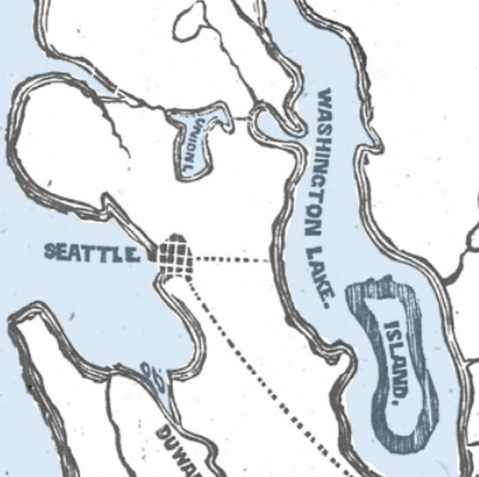
1864 - Apparently, maps makers were still unsure of which came first, the name or the descriptor. This map accompanied a Seattle Gazette article about coal that proposed cutting a canal from Lake Washington to Lake Union, noting that “it is contended that a mere ditch through which to turn the water is all that is required, and the canal will make itself.” Alas, no ditch was cut and the canal would remain a dream for another two decades.
1875 - Since no canal had been built, the coal industry relied on rail to move coal from the east side of Lake Washington via barge to Union Bay, which is shown on the map. The coal was then portaged between lakes, loaded on another barge and taken to a rail depot at the south end of Lake Union, where it went on the city’s first train, the Seattle Coal and Transportation Railroad, and was taken to coal bunkers on Elliott Bay.
1894 - The lake originally extended farther south than at present, to about Mercer Street; a sawmill on the south end created debris used for fill. A trolley on the west side of the lake ran on pilings that carried the tracks over water. Also note the canal connecting Lake Washington at Lake Union, roughly where modern day SR-520 runs, as well as the outlet creek, (called Ross Creek but not labeled as such).
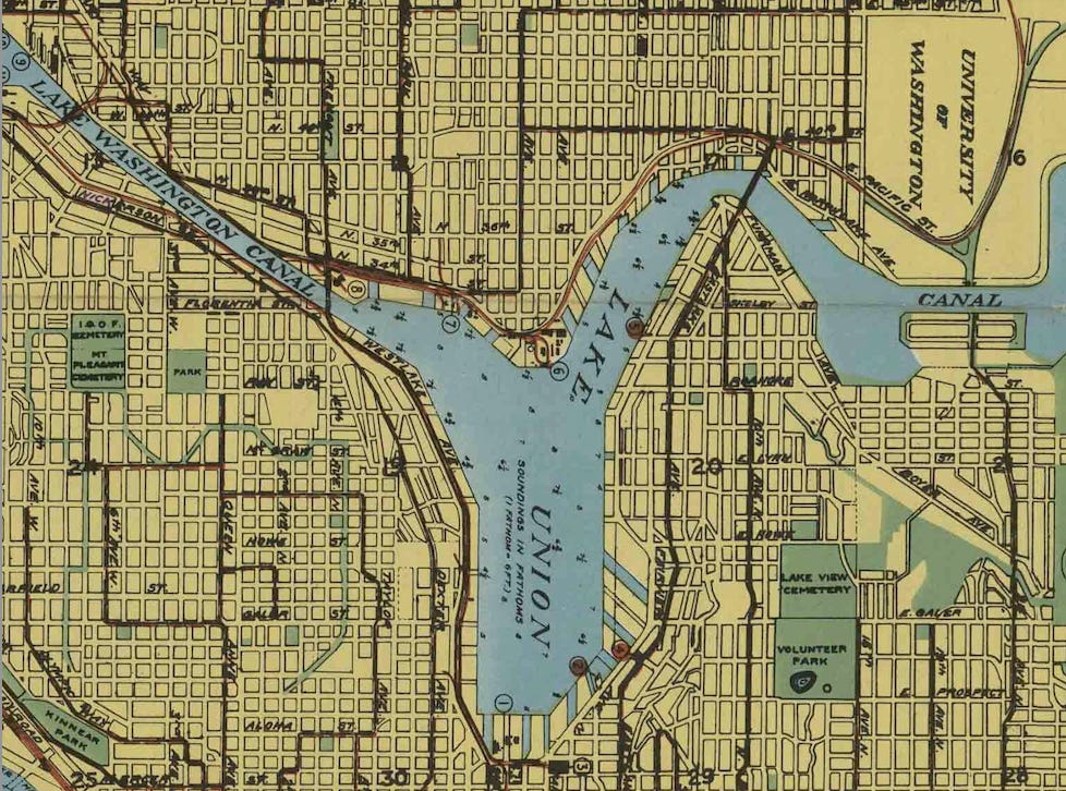
1918 - The Government Locks (as it was called then) and the ship canals have opened. Note that no bridge crosses the Montlake Cut. Most of the fingerlike waterways were created due to a plan to sell off shoreland in order to finance Seattle’s first world’s fair, the Alaska Yukon Pacific Exhibition.
1949 - By the middle of the 20th century, the lake was fully industrialized, a bridge had been built across the Montlake Cut (1925), you could play golf along the Cut, and you couldn’t take I-5 because it didn’t exist. The gas tanks at the north end were for a coal gasification plant and the Naval Reserve Training Center is now MOHAI. Extra points if you regularly call the Aurora Bridge by its proper name.
Originally shaped by glaciers, then shaped by people, Lake Union has long been a microcosm of the many changes, good and bad, that led to modern day Seattle. What will a map of it look like in another 167 years?


Hi David, you wrote:
> 1875 - Since no canal had been built, the coal industry relied on rail to move coal from the east side of Lake Washington via barge to Union Bay ...
Physical of evidence of that remains. Eighteen wood coal railroad cars sank off a barge in 1875. They are almost perfectly preserved and still sit on the bottom of the lake full of coal, roughly in the middle of Lake Washington off of Madison Park, about 200 feet down. (Thanks to exploration diver Scott Boyd for this info. https://www.boydski.com/diving/Lake_Washington_Wrecks.htm )
Fun post! Love the map from 1918 that resembles yellowy Kroll classics that I used as navigation aids as a kid. The post also reminds me that a game changing event in modern Seattleites’ understanding of Lake Union was development of this great urban trail and associated signage: https://www.seattle.gov/parks/allparks/cheshiahud-lake-union-loop