From 1884 to 1941, Seattle had an extensive trolley and cable car system that stretched across the city. Initially pulled by horses and then by cables, the system was soon almost entirely powered by overhead, electric wires. At a time when few people owned cars, the trolleys and cable cars were widely used, peaking in 1919 with 133 million riders, or an average of a little over a ride a day for the city’s 315,000 residents. But then in 1941, the entire system was scrapped, the rails were removed, and the old trolleys replaced by modern buses. A central reason was the rise of the automobile, which decreased trolley ridership, reduced revenue, and led to crowded streets. Of course, the Depression didn’t help either.
Fortunately, one can still find many clues around town from Seattle’s trolley and cable car system. Here are a few. Please let me know if you know of others.
The Interurban Building - 102 Occidental Avenue - Designed by John Parkinson (you can see his name on the east side of the building) as the Seattle National Bank, The Interurban became the headquarters for the Seattle-Tacoma Interurban in 1904. It ran from 1902 to 1928 between Puget Sound’s two biggest cities. (70 minutes for the express and 95 for local.) The sandstone, coincidentally (because of the carved lion over the Occidental entrance) called the Lyons Sandstone, is a 280 million year old rock quarried in Manitou Springs, Colorado.
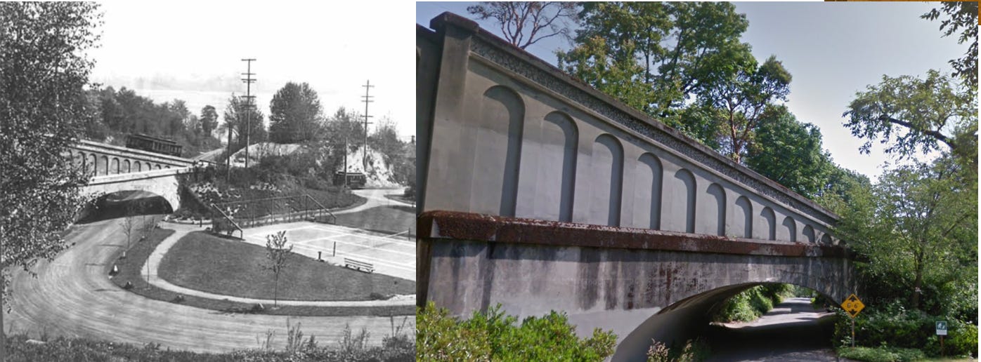
Yesler Cable Car Bridge - Seattle’s first cable car opened in 1887, carrying people from Pioneer Square to Leschi. It operated until August 10, 1940, becoming the final street trolley route to be dismantled.
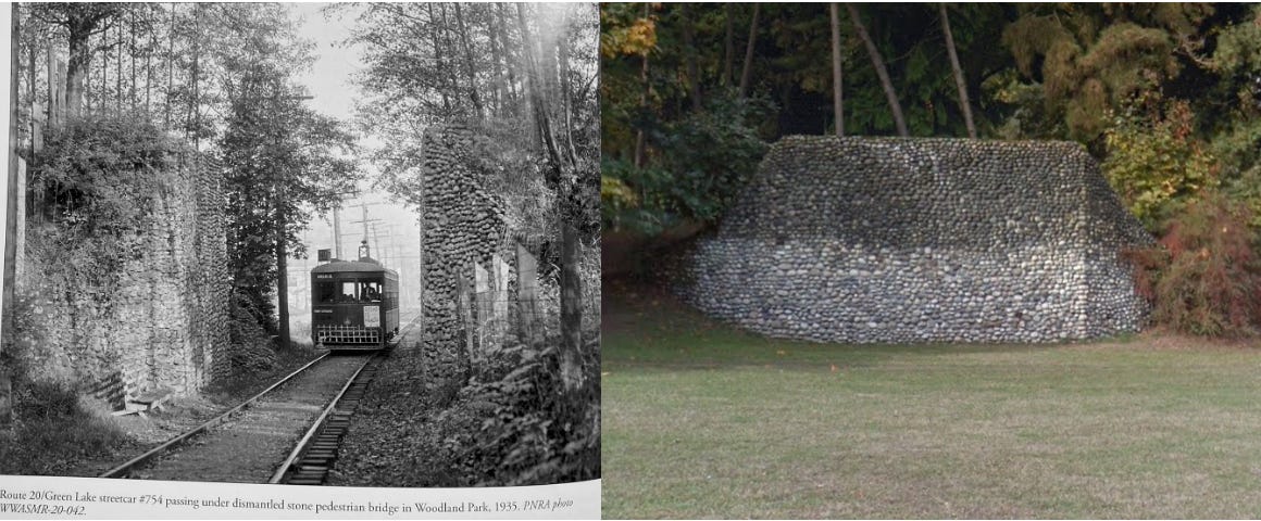
Green Lake Trolley - Woodland Park - Started in 1891, Route 20 was the first to the north end of Seattle. The route looped around Green Lake, originally closer to the shoreline. At the suggestion of John Charles Olmsted, the lake was lowered by seven feet to increase the amount of land for a park. The wall was one of two that supported a pedestrian span, built before the construction of Aurora Avenue cut through the park, according to Mike Bergman, author of Seattle’s Streetcar Era.
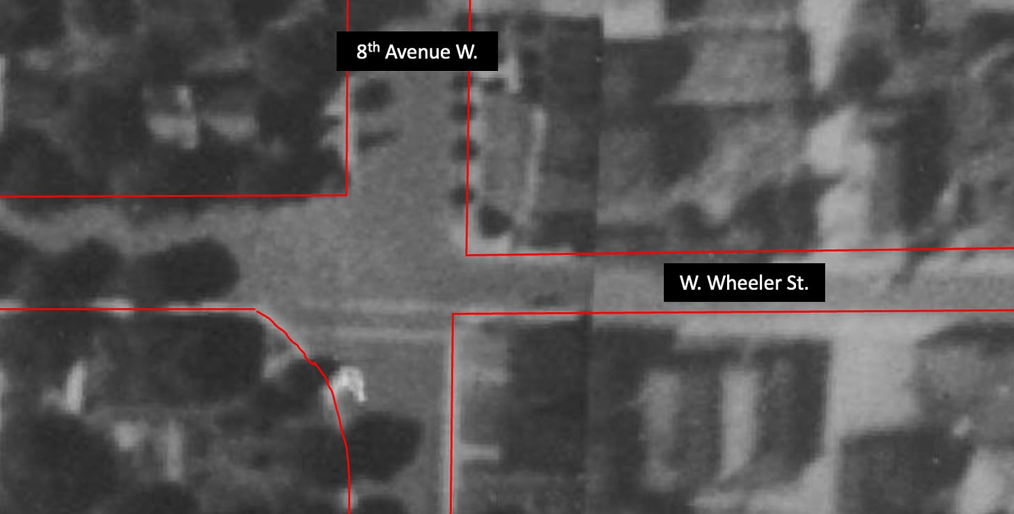
Street corner cuts - In several locations, street corners are not at 90 degree angles but were rounded to facilitate a trolley, such as Route 1, turning the corner.
Arced pavement - In several other locations, you can see pavement that fills in the location of the old tracks where the trolley cars turned. A good example is at NE 55th Street and 35th Avenue, where the Route 8 Ravenna route ended and the cars turned around.

Extra Wide Streets - Unlike Utah where the streets were made wide to turn around a wagon, many Seattle streets, such as the one where I live are so narrow that if cars are parked on either side two cars going in the opposite direction cannot pass each other. But some of our streets are Utahonic in their width. One good example due to trolleys is 14th Avenue NW in Ballard, the historic path of the Route 27 North Ballard Line, the rails of which still remain.
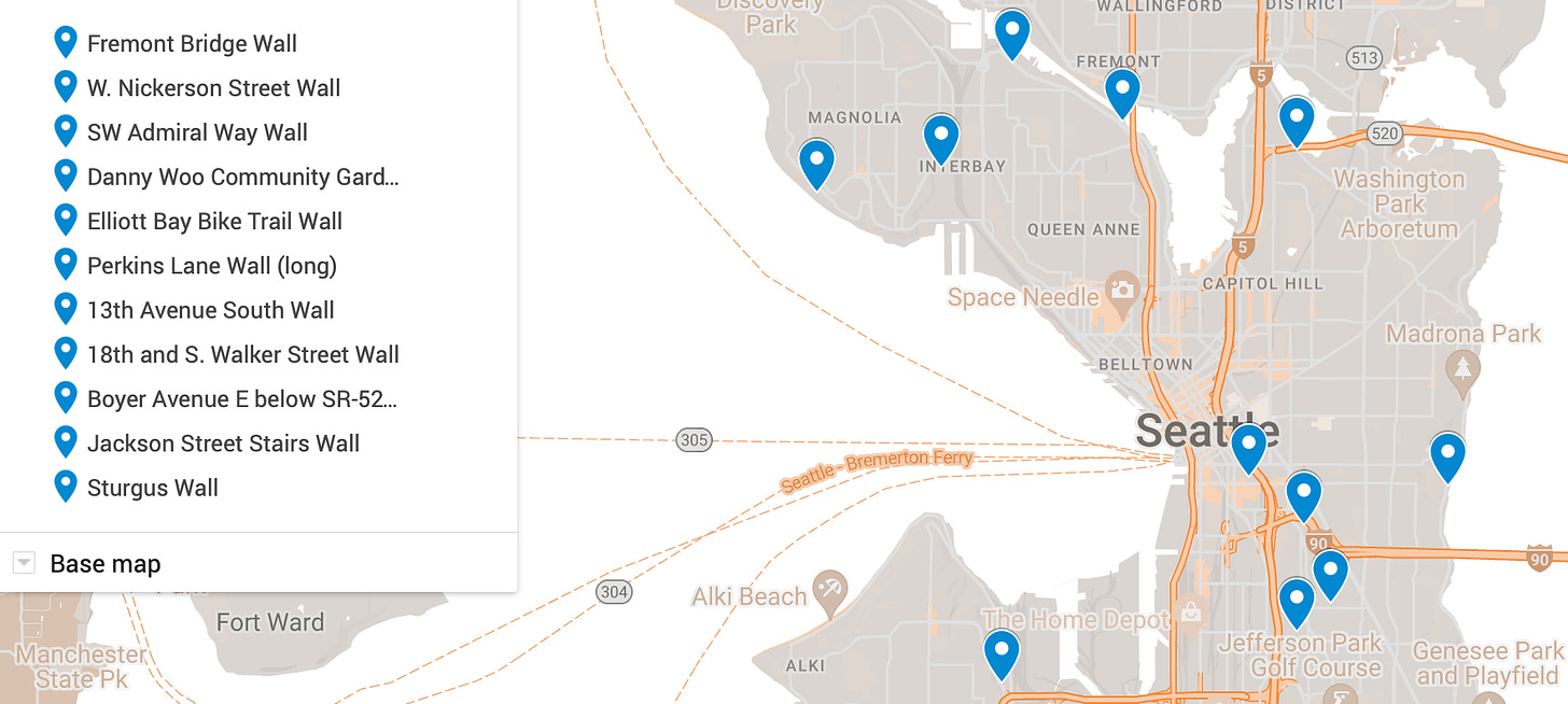
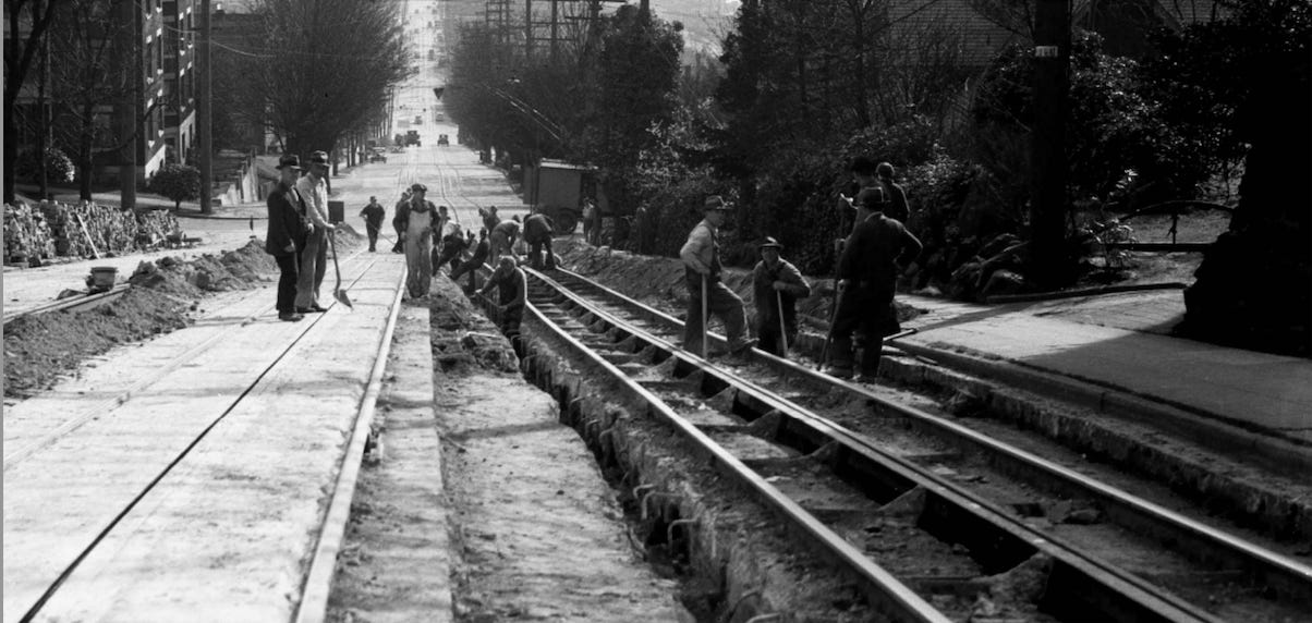
Retaining Walls and Stairs - When the city ripped up the street trolley system in 1941, they saved many of the rails and concrete street slabs and used them for retaining walls and stairways. Understandably, many of the stairways have been updated for modern safety requirements but concrete-slab retaining walls occur across the city.
Modern Trolley Lines - Look at the modern routes of Metro’s electric trolleys (Routes 1, 2, 3, 4, 10. 12, 13, 14, 36, 43, 44, 49, and 70) and note how several, such as the 1, 2, 3, 4, 10, and 13, correspond with historic trolley routes.
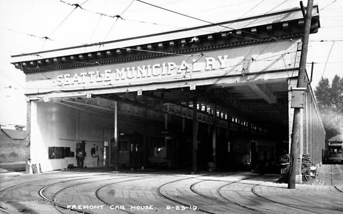
Fremont Trolley Barn - Built in 1905 by Seattle Electric Company, the building could accommodate five tracks, had a pit where employees could work on trolley underbellies, and a wash tower for cleaning cars. It served the Fremont, Ballard, Phinney, and Green Lake lines. Trolleys used the building until April 1941, followed by the US Army, which stored gear during WWII. It was eventually purchased by Red Hook Brewery and Theo Chocolate.
The Counterbalance - I am not sure how many people still refer to the steep, south side of Queen Anne Hill as the Counterbalance but for those of us who do, the name harkens back to the days of the knoll’s former trolley car. Under the street, and still there, were a pair of 16-ton weights used to counter the weight of the street cars that went up and down the hill. The tunnels that carried the weights still exist though the access is sealed and to do go down in them one would need a “confined spaces” permit and probably safety hoists and air exchange fans. You can learn more at Counterbalance Park, at the base of the hill.
Endolyne - The fine people near Fauntleroy apparently coined the name Endolyne for their neighborhood, in honor of it being the end of the line of Route 2, which opened in 1907. Along with The Counterbalance, this was the only neighborhood or street name I found associated with the trolley system. Let me know if there are others.
Thanks to Mike Bergman and Richard Miller for answering my many questions. If you are interested in the trolley system, I highly recommend Mike’s book, Seattle’s Streetcar Era.



Thanks for the great read. I live on Metro Route 4 in Judkins Park and reflect often on the connection to the old trolley system.
With regards to the retaining walls, are they these waist-high walls for example here [1] and here [2]? Are both the beams and the concrete from the trolley system? Amazing if so -- I would have never guessed just by looking at them.
1: https://www.google.com/maps/@47.5838627,-122.3095037,3a,75y,271.77h,79.62t/data=!3m6!1e1!3m4!1sS9akcQdEJu6MReUQja4heg!2e0!7i13312!8i6656?entry=ttu
2: https://www.google.com/maps/@47.5939857,-122.3144078,3a,75y,226.88h,72.24t/data=!3m7!1e1!3m5!1sPAEz8UzsMcHd87ZGvMx-ug!2e0!6shttps:%2F%2Fstreetviewpixels-pa.googleapis.com%2Fv1%2Fthumbnail%3Fpanoid%3DPAEz8UzsMcHd87ZGvMx-ug%26cb_client%3Dmaps_sv.tactile.gps%26w%3D203%26h%3D100%26yaw%3D326.00327%26pitch%3D0%26thumbfov%3D100!7i16384!8i8192?entry=ttu
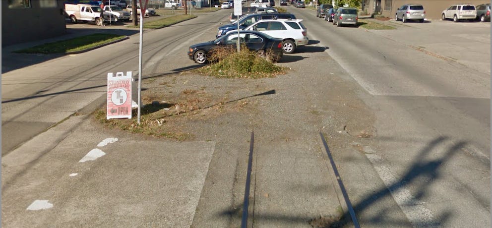
Great article. When Olympic Way W on the SW slope of Queen Anne was repaved a few years ago some tracks were exposed. The asphalt is now cracked, indicating the rail locations if you know where to look.
I have also heard that the building at 1821 10th Ave W had trolley maintenance facilities, but I have never been able to find any documentation. Curious if anyone has any info.